Lake Park Campground - Rapid City, SD
The Mount Rushmore
National Memorial is centered on a colossal sculpture carved
into the granite face of Mount Rushmore in the Black Hills near Keystone,
South Dakota. Sculptor Gutzon Borglum designed the
sculpture, called Shrine of Democracy, and oversaw the project's
execution from 1927 to 1941 with the help of his son. The
sculpture features the 60-foot-tall heads of four United States presidents: George
Washington, Thomas Jefferson, Theodore Roosevelt, and Abraham
Lincoln. These were chosen to represent the nation's birth, growth, development and preservation,
respectively. Mount Rushmore attracts more than two million visitors
annually to the memorial park which covers 1,278 acres.
The sculptor chose Mount Rushmore in part because it faces
southeast for maximum sun exposure. The carving was the idea of Doane
Robinson, a historian for the state of South Dakota.
Peter Norbeck, U.S. senator from South Dakota,
sponsored the project and secured federal funding. Construction began in
1927 and the presidents' faces were completed between 1934 and 1939.
The sculpture at Mount Rushmore is built on land that was
illegally taken from the Sioux Nation in the 1870's. The Sioux continue
to demand return of their land. In 1980, the US Supreme Court ruled in United
States v. Sioux Nation of Indians that the taking of the Black Hills
required just compensation, and awarded the tribe $102 million. The Sioux have
refused the money, which has grown with interest to over a billion dollars, and continue to demand the return of their land. This conflict continues, leading some critics of
the monument to refer to it as a "Shrine of Hypocrisy".

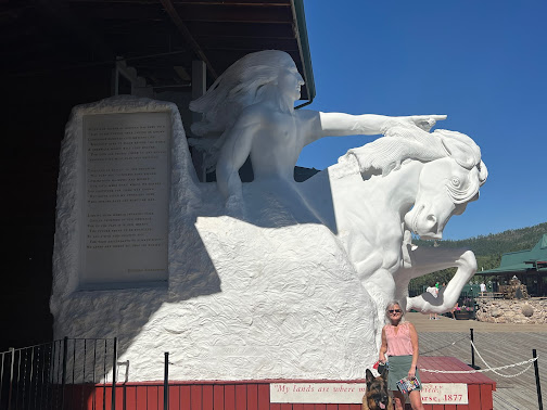
The Crazy Horse
Memorial is a mountain monument under construction on privately
held land in the Black Hills of South Dakota. It will depict the Oglala Lakota warrior Crazy
Horse, riding a horse and pointing to his tribal land. The memorial was
commissioned by Henry Standing Bear, a Lakota elder, to be sculpted by Korczak
Ziolkowski. The Crazy Horse Memorial Foundation, a nonprofit
organization, oversees the project and the funding.
The monument has been in progress since 1948 and is far from
completion. If completed as designed, it will become the world's
second tallest statue, following the Statue of Unity in India.
The memorial master plan
includes the mountain carving monument, a Native American Museum of North
America, and a Native American Cultural Center. The monument is being carved
out of Thunderhead Mountain, on land considered sacred by some Oglala
Lakota, between Custer and Hill City, roughly 17 miles from Mount
Rushmore.
The sculpture's final dimensions are planned to be 641 feet long
and 563 feet high. The outstretched arm will be 263 feet long, the opening
under arm 70 feet wide and 100 feet high, and the pointing finger 29 feet
6 inches long. The face of
Crazy Horse, completed in 1998, is 87 feet 6 inches high. For comparison, the heads of the four U.S. Presidents at Mount Rushmore are each 60
feet high.
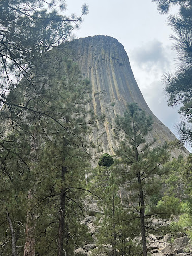
Devils Tower (also known
as Bear Lodge Butte) is a butte, possibly laccolithic (dome shaped rock formed when magna rises up through the earth's crust),
composed of igneous rock in the Bear Lodge Ranger District of the Black
Hills, above the Belle, Fourche River. It rises 1,267 feet above the Belle Fourche River, standing 867 feet from summit to base. The
summit is 5,112 feet above sea level.
Devils Tower National Monument was the first designated United States national monument, established in September 1906, by President Theodore Roosevelt. The monument's boundary encloses an area of 1,347 acres. Not all National Monuments end up being designated as National Parks.
Portions
of US 16A are known as the Iron Mountain Road, named after the peak it summits.
US 16A is famous for
its scenic, one-lane tunnels aligned to frame the faces on Mount Rushmore, its "pigtail
bridges", and its sections of divided highway but with single (and narrow)
lanes on each roadway.
The route includes most of the tunnels on the South Dakota state highway system, including the only three-lane tunnel in the state, just north of Keystone. Part of the highway is also a boundary of the Black Elk Wilderness. The Iron Mountain portion of the road is not maintained in the winter. The road, like several other scenic roads in the Black Hills, was originally laid out by Governor Peter Norbeck, specifically to create a very scenic, slow-speed road for tourists. The section of US 16A from SD 89 to SD 244 is known as the Peter Norbeck Memorial Byway in honor of the governor. At the highest point of the byway, on the summit of Iron Mountain, there is a small memorial to Governor Norbeck.
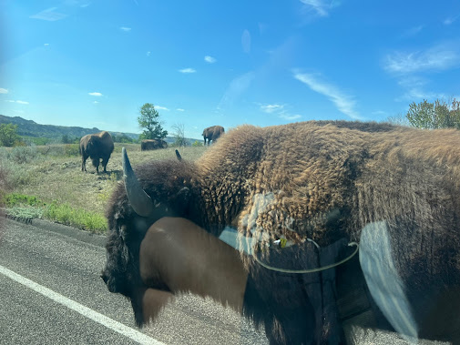
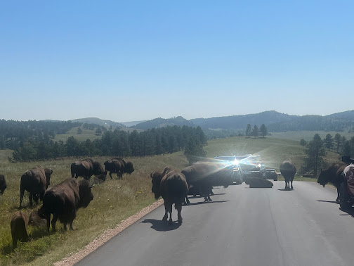
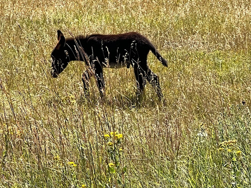
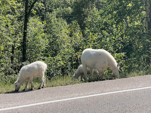
The park is home to a herd of 1,500 bison. elk, coyotes, mule deer, white tailed deer, mountain goats, prairie dogs, bighorn sheep, river otters, pronghorn, cougars, and feral burros also inhabit the park. The park is known for its scenery, its scenic drives (Needles Highway and the wildlife loop) with views of the bison herds and prairie dog towns.
The area originally started out as sixteen sections, but was later changed into one block of land because of the challenges of the terrain. The park began to grow rapidly in the 1920's and new land was added as it became available. During the 1930's, the Civilian Conservation Corps built miles of roads, laid out parks and campgrounds, and built three dams that set up a future of water recreation at the park. In 1964, an additional 22,900 acres were added to the park.
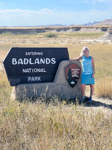
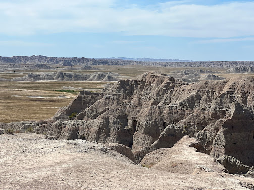
Badlands National Park is located
in southwestern South Dakota. The park protects 242,756 acres of sharply eroded buttes and pinnacles,
along with the largest undisturbed mixed grass prairie in the United
States. The National Park Service manages the park, with the South
Unit being co-managed with the Oglala Lakota tribe.
The Badlands Wilderness
protects 64,144 acres of the park's North Unit as a designated wilderness
area, and is one site where the black-footed ferret, one of the most endangered mammals
in the world, was reintroduced to the wild. The South Unit, or
Stronghold District, includes sites of 1890s Ghost Dances, and Red
Shirt Table, the park's highest point at 3,340 feet.
Authorized as Badlands
National Monument in March 1929, it was not established until January 1939. The Badlands was re-designated as a national park in November 1978. Under
the Mission 66 plan, the Ben Reifel Visitor Center was constructed
for the monument in 1957–58. The park also administers the nearby Minuteman
Missile National Historic Site.
This national park land was
originally a reservation of the Oglala Sioux Indians and spans the southern
unit of the park. The area around Stronghold Table was originally Sioux
territory, and is revered as a ceremonial sacred site rather than a place to
live.
In 1868, at the Second
Treaty of Fort Laramie, the United States assured the Sioux that the Badlands
shall forever be the property of the Sioux. In 1889, however, the treaty was
broken and the Badlands were confiscated by the United States and unilaterally
incorporated into a national park.
At the end of the 19th
century, the Sioux Indians used this area as the site of the Ghost Dance, a
ceremony to revive the souls of buffalo and the dead. After the last ghost
dance in 1890, the United States banned the ritual. It was revived by the Red
Power movement, a movement to restore Indian rights that began in the 1960s. In
1980, the U.S. Supreme Court awarded compensation to the Sioux for abolishing the 1868 treaty, but the Sioux did not accept the money.
Wall Drug Store, often called simply Wall Drug, is a roadside attraction and tourist stop located in the town of Wall, South Dakota, adjacent to the Badlands National Park. Wall Drug consists of a collection of cowboy-themed stores, including a drug store, gift shop, several restaurants, and various other stores, as well as an art gallery and an 80-foot brontosaurus sculpture. Unlike a traditional shopping mall, all the stores at Wall Drug operate under a single entity rather than being run individually. The New York Times described Wall Drug as "a sprawling tourist attraction of international renown that draws some two million annual visitors to a remote town".
The small-town drugstore made its first step towards fame when it was purchased by Ted Hustead in 1931. Hustead was a Nebraska native and pharmacist who was looking for a small town to establish his business. He bought Wall Drug, located in a 231-person town in what he referred to as "the middle of nowhere," and strove to make a living. Business was very slow until his wife, Dorothy, thought of advertising free ice water to thirsty travelers heading to the newly opened Mount Rushmore monument 60 miles to the west. From that time on, business was brisk. To this day, Walls still offers free ice water to their guests. To honor our military, Wall's Drugs began offering free coffee and a donut to each veteran/service member.
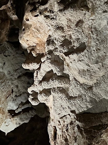
Jewel Cave National
Monument is currently the fifth longest cave in the
world, with 217.32 miles of mapped passageways. It became a national
monument in 1908.
Frank and Albert Michaud, two local
prospectors, discovered the cave in 1900, when they felt cold air blowing out
of a small hole in a canyon. It is unknown whether any previous inhabitants of
the area were aware of the natural cave opening, which was not large enough for
a person to enter.
After enlarging the cave entrance with
dynamite, the Michaud brothers found a cavern lined with calcite crystals,
which led them to name it "Jewel Cave". The brothers tried to
capitalize on the discovery, widening the opening, building walkways inside,
and opening it to tourists. Although their venture was unsuccessful, news of
the discovery eventually reached Washington. President Theodore Roosevelt proclaimed
Jewel Cave a National Monument in February 1908. The area around the
natural entrance to the cave was further developed by the Civilian
Conservation Corps in the 1930s. The National Park Service assumed
management of the monument in 1933 and began offering tours in 1939.
As recently as 1959, less than 2 miles of passageway had been discovered. That year, however, Herb
and Jan Conn, local rock climbers, began exploring, and within two years had
mapped 15 miles. Much of the new discoveries lay outside the
boundaries of the monument, under land managed by the United States Forest
Service. The two agencies performed a land swap in 1965, establishing the
present boundaries of the park, and enabling the development of a new part of
the cave. The Park Service sunk a 300 feet elevator shaft to a previously
remote cave area, and built concrete walks and metal stairs and platforms along
a one-half-mile loop. The "Scenic Tour" was opened in 1972. Most
modern-day visitors tour that part of the cave.
By
1979, Herb and Jan Conn had discovered, named, and mapped more than
64 miles of passages. Although they largely retired from caving by the early
1980s, exploration has continued unabated. Because the areas being explored
take many hours to reach, explorers now sometimes camp in the cave during
expeditions of as long as four days. The cave is mapped by traditional survey
techniques, using compass, clinometer and today with lasers
instead of tape measures.
Its 217 miles of mapped passageway make
Jewel Cave the fifth longest cave in the world.
Jewel Cave is a
"breathing cave", which means air enters or exits the cave with
changes in atmospheric pressure from day to night or due to
changes in the weather. This was first explained by Herb Conn in 1966.
The discovered areas in the cave account for only about 3 to 5% of the estimated total air volume of the cave. The cave volume is estimated by measuring the amount of air that the cave "exhales" when the outside air pressure drops and "inhales" when the outside air pressure rises.


























No comments:
Post a Comment