Moab Rim RV Park and Campground- Moab, Utah
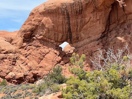
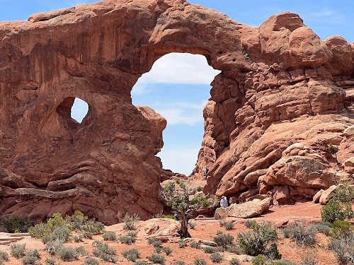
Arches National Park is a national
park in eastern Utah. The park is adjacent to
the Colorado River. More than
2,000 natural sandstone arches are located in the park, including the
well-known Delicate Arch, as well as a variety of unique geological
resources and formations. The park contains the highest density of natural
arches in the world.
The park consists of 76,680 acres; of
high desert located on the Colorado Plateau. The highest elevation in
the park is 5,653 feet at Elephant Butte, and the lowest elevation is
4,085 feet at the visitor center. The park receives an average of less than
10 inches of rain annually.
As stated in the foundation document
in U.S. National Park Service website:
The purpose of Arches National Park is
to protect extraordinary examples of geologic features including arches,
natural bridges, windows, spires, and balanced rocks, as well as other features
of geologic, historic, and scientific interest, and to provide opportunities to
experience these resources and their associated values in their majestic
natural settings.
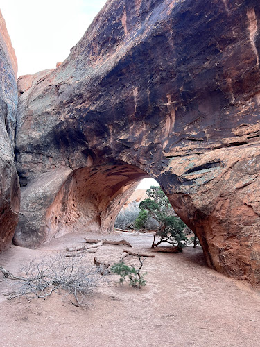
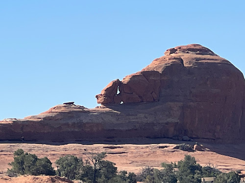
All of the arches in the park are made
of Entrada Sandstone, however, there are slight differences in how each arch
was developed. This allows the Entrada Sandstone to be categorized into 3
groups including Slick rock members, Dewey rock members, and Moab
members. Vertical arches can be developed from Slick rock members, a
combination of Slick rock members and Moab members, or Slick rock members
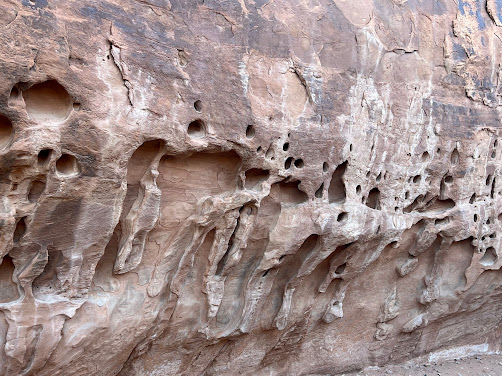
resting above Dewey rock members. Horizontal arches (also called potholes) are
formed when a vertical pothole formation meets a horizontal cave, causing
a union into a long arch structure. The erosion process within Arches National
Park will continue as time continues to pass. Continued erosion combined with
vertical and horizontal stress will eventually cause arches to collapse, but
still, new arches will continue to form for thousands of years.
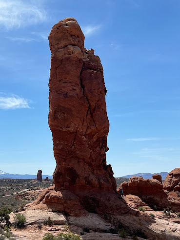
The total height of Balanced Rock is 128 feet, with the balancing rock rising 55 feet above the base. This rock is the largest of its kind in the park, weighing approximately 3,577 tons. Balanced Rock is composed of the hard Slick Rock Member of the Entrada Sandstone. It sits on a pedestal of the softer Dewey Bridge Member which erodes faster than then the rock above. This will cause the eventual collapse of balanced rock. It seems like we seen some balanced rocks in every park and many along the roadside, but this is the most well known.
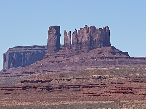
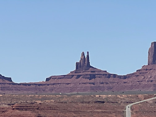
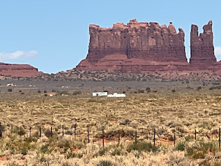
Monument
Valley is a region of the Colorado Plateau characterized by a cluster
of sandstone buttes, the largest reaching 1,000 ft above the valley
floor. It is located on the Utah–Arizona state line, near the Four Corners area.
The valley is a sacred area that lies within the territory of the Navajo
Nation Reservation, the Native American people of the area.
Monument
Valley has been featured in many forms of media since the 1930s.
Director John Ford used the location for a number of his Westerns;
critic Keith Phipps wrote that "its five square miles have
defined what decades of moviegoers think of when they imagine the American
West".
The
area is part of the Colorado Plateau. The elevation of the valley floor
ranges from 5,000 to 6,000 feet above sea level. The floor is largely siltstone of
the Cutler Group, or sand derived from it, deposited by the meandering
rivers that carved the valley. The valley's vivid red color comes from iron
oxide exposed in the weathered siltstone. The darker, blue-gray rocks
in the valley get their color from manganese oxide.
The buttes are
clearly stratified, with three principal layers. The lowest layer is
the Organ Rock Shale, the middle is de Chelly Sandstone, and the top
layer is the Moenkopi Formation capped by Shinarump Conglomerate.
Newspaper
Rock State Historic Monument is a Utah state monument featuring a rock
panel carved with one of the largest known collections of petroglyphs
The
200-square-foot (19 m2) rock is a part of the vertical Wingate sandstone cliffs
that enclose the upper end of Indian Creek Canyon, and is covered by hundreds
of petroglyphs—one of the largest, best preserved and easily accessed
groups in the Southwest. The petroglyphs feature a mixture of human,
animal, material and abstract forms.
The
first carvings at the Newspaper Rock site were made around 2,000 years ago,
left by people from the Archaic, Anasazi, Fremont, Navajo, Anglo, and Pueblo
cultures.
In Navajo,
the rock is called "Tse' Hone'" which translates to a rock that tells
a story.
The
petroglyphs were carved by Native Americans during both the prehistoric and
historic periods. There are over 650 rock art designs. The drawings on the rock
are of different animals, human figures, and symbols. These carvings include
pictures of deer, buffalo, and pronghorn antelope. Some glyphs depict riders
on horses, while other images depict past events like in a newspaper.
While precisely dating the rock carvings has been difficult, repatination of
surface minerals reveals their relative ages. The reason for the large
concentration of the petroglyphs is unclear. One suggested explanation is that
the rock was used as a place for communication through the petroglyphs between
travelers.
The
pictures at Newspaper Rock were inscribed into the dark coating on the rock,
called desert varnish. Desert varnish is mainly made up (~70%) by clay
materials, but gets its blackish color from iron and manganese oxide deposits
that gradually form on exposed sandstone cliff faces owing to the action of
rainfall and bacteria. The ancient artists produced the many types of
figures and patterns by carefully chipping the coated rock surfaces with
sharpened tools to remove the desert varnish and expose the lighter rock beneath.
The older figures are themselves becoming darker in color as new varnish slowly
develops.
Canyonlands National Park is
an American national park located in southeastern Utah near
the town of Moab. The park preserves a colorful landscape eroded into
numerous canyons, mesas, and buttes by the Colorado
River, the Green River, and their respective tributaries.
The park is divided into four districts: the Island in the Sky,
the Needles, the Maze, and the combined rivers—the Green and Colorado—which
carved two large canyons into the Colorado Plateau. While these areas
share a primitive desert atmosphere, each retains its own character. Author Edward
Abbey, a frequent visitor, described the Canyonlands as "the most weird,
wonderful, magical place on earth—there is nothing else like it anywhere."
In the early 1950s, Bates
Wilson, then superintendent of Arches National Monument, began exploring
the area to the south and west of Moab, Utah. After seeing what is now
known as the Needles District of Canyonlands National Park, Wilson began
advocating for the establishment of a new national park that would include the
Needles. Additional explorations by Wilson and others expanded the areas
proposed for inclusion into the new national park to include the confluence of
Green and Colorado rivers, the Maze District, and Horseshoe Canyon.
In 1961, Secretary of the Interior Stewart Udall was scheduled to address a conference at Grand Canyon National Park. On his flight to the conference, he flew over the Confluence (where the Colorado and Green rivers meet). The view apparently sparked Udall's interest in Wilson's proposal for a new national park in that area and Udall began promoting the establishment of Canyonlands National Park.
In September, 1964, after several years of debate, President Lyndon
B. Johnson signed Pub. L. 88–590, which established
Canyonlands National Park as a new national park. Bates Wilson became the first
superintendent of the new park and is often referred to as the "Father of
Canyonlands."
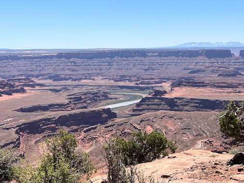
Dead Horse Point State Park is a state park in San Juan County, Utah in the United States, featuring a dramatic overlook of the Colorado River and Canyonlands National Park. According to legend, the park is so named because of its use as a natural corral by cowboys in the 19th century, where horses often died of exposure. Dead Horse Point has frequently been noted on lists of unusual place names.
























.JPG)


No comments:
Post a Comment