Zion River Resort RV Park and Campground - Virgin, UT
The highlight of this stop was we had Megan and Adrian with us for a few days. We were so thankful they were able to escape work for a week to come see us.
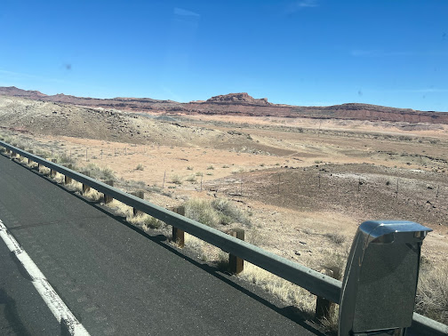
The drive from Williams, Arizona to Virgin, Utah took us through the Vermilion Cliffs National
Monument. The Vermillion Cliffs National monument is located in northern Coconino County, AZ, immediately south of the Utah state line. This national monument is located within 293,689 acres that protects the Paria Plateau, Vermilion Cliffs, Coyote
Buttes, and Paria Canyon. Elevations in the monument range from 3,100 feet
to 6,500 feet above sea level.
Established on November 9, 2000 by a presidential
proclamation by President Bill Clinton, Vermilion Cliffs National
Monument was carved from existing lands already under the management of the U.S.
Government. The monument is administered by the U.S. Bureau of Land
Management (BLM), an agency within the U.S. Department of the Interior. The
Vermilion Cliffs themselves run along the southern and eastern edges of the
monument. Much of the monument's land consists of the Paria Plateau, a flat
area extending northward from the tops of the cliffs.
BLM land is open to the public, typically free of charge, for hiking, ATV's and camping. Camping on BLM land is called boondocking- free but with no hookups. We have no interest in boondocking. The cost of running our generator is typically about the same as paying for a campground site with full hookups. Some people have solar set ups for power, but the initial cost is huge. We cannot justify the cost of the equipment compared to the savings from boondocking.
Karma was riding shotgun and navigating while Lisa took a nap. He is loving this lifestyle and does so well while traveling. We are amazed how much he has learned to read our cues and routines.
Look at that gorgeous blue sky. It was truly a perfect day to be outside.
Karma has learned to assume the position for Mark to take a picture. He definitely keeps us entertained. The list of words he knows seems to grow by the day.
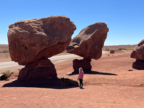
Karma manages to find some shade every chance he gets.
These massive boulders are balanced upon smaller rocks with no outside support. This is truly a miracle of nature.
These were huts from the time of the Cliff Dwellers that lived in the area. Many lived in these huts before they transitioned to cave dwellings. These are at least 700+ years old, and the mortar they used is still standing. Maybe we need to make it like they did.
Mark asked, how far below the earths surface does the Ice Cream cone have to go to prevent it from falling over?
__________________________________
Zion National Park is located in southwestern Utah, near
the town of Springdale. Located at the junction of the Colorado
Plateau, Great Basin, and Mojave Desert regions, the park has a
unique geography and a variety of life zones that allow for
unusual plant and animal diversity.
Zion National Park includes mountains, canyons, buttes, mesas, monoliths, rivers, slot
canyons, and natural arches. The lowest point in the park is 3,666 feet
at Coalpits Wash and the highest peak is 8,726 feet at Horse Ranch
Mountain. A prominent feature of the 229-square-mile park is Zion Canyon,
which is 15 miles long and up to 2,640 feet deep. The canyon walls are
reddish and tan-colored Navajo Sandstone eroded by the North Fork of
the Virgin River.
Human habitation of the area started about 8,000 years ago
with small family groups of Native Americans, one of which was the
semi-nomadic Basketmaker Ancestral Puebloans (who used to be
called Anasazi by early non-indigenous archeologists)(c. 300 AD). Subsequently, what has been called the Virgin Anasazi culture (c. 500)
and the Parowan Fremont group developed as the Basketmakers settled
in permanent communities. Both groups moved away by 1300 and were replaced
by the Parrusits and several other Southern Paiute subtribes. Mormons came
into the area in 1858 and settled there in the early 1860's. In 1909, President William
Howard Taft named the area Mukuntuweap National Monument in order to
protect the canyon. In 1918, the acting director of the newly created National
Park Service, Horace Albright, drafted a proposal to enlarge the existing
monument and change the park's name to Zion National Monument. Zion was a term used by the Mormons. According to historian Hal Rothman:
"The name change played to a prevalent bias of the time. Many believed
that Spanish and Indian names would deter visitors who, if they could not
pronounce the name of a place, might not bother to visit it. The new name,
Zion, had greater appeal to an ethnocentric audience." On November
19, 1919, Congress re-designated the monument as Zion National Park,
and the act was signed by President Woodrow Wilson. The
Kolob section was proclaimed a separate Zion National Monument in 1937, but was
incorporated into the national park in 1956. Congress designated 85% of
the park a wilderness area in 2009.
The geology of the Zion and Kolob canyons area includes
nine formations that together represent 150 million years of mostly Mesozoic-aged sedimentation.
At various periods in that time, warm, shallow seas, streams, ponds and lakes,
vast deserts, and dry near-shore environments covered the area. Uplift
associated with the creation of the Colorado Plateau lifted the
region 10,000 feet starting 13 million years ago.
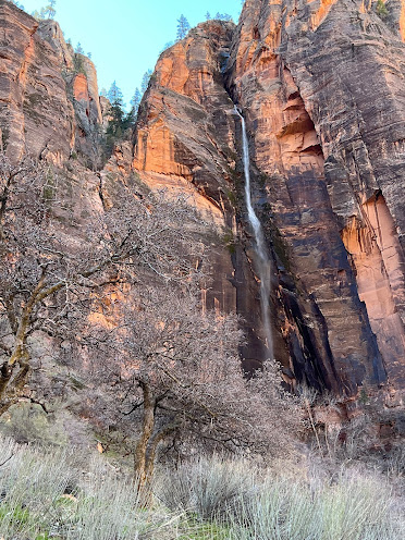
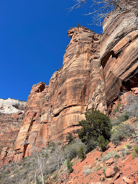
We saw several climbers on the cliff walls in Zion.
It was a cool but perfect day. We rode our bikes the full length of the bike trail throughout the park.
These mule deer were on the side of the biking path. We were within 15 feet of them. They barely even looked our way.
Lisa was hanging out with one of the CCC workers. I really have to keep my eye on her.
Karma was questioning the common sense of hiking up hill. We would love to know his thoughts.
These were views from the Coal Pits Wash Trail.
There was snow on the mountains and we were wearing shorts and tee shirts.
________________________
Whole Guacamole Trail in Virgin, Utah is on BLM land at the top of a Mountain just outside of Zion National Park. It is a multipurpose trail for hikers and mountain bikers. The area around the trailhead is also used by Boondockers. We were hiking it on a Friday as they were preparing for an Ultra- Marathon (100 miles). Unfortunately, we were too late to sign up. We were able to question the race workers at mile markers 57 and 64. The race was to start at 5;00 AM Saturday morning. They expected to start seeing runners around noon. Obviously, those are the fastest and most serious of the runners. They told us some would still be running on Sunday morning. We could not remotely fathom running 100 miles, much less running it for over 24 hours.
Lisa and Karma were taking a breather on the Whole Guacamole trail.
Petrified wood was all over the mountain. Lisa ended up with her pockets full of rocks.
This was a different variety of cactus we had not seen before.
Wild horses were on the BLM land. They came right up to us, totally unafraid. Karma was taken with them and at one point was so close, one kicked him in the head. He had his bell rung twice before he realized standing behind a horse is not a good place to be.
The rock was eaten away by the wind and water. There are so many variations in the rock composition, the erosion and the results of the entire process.
Lisa was inspecting the rocks and the caves along our adventure.
There were fertile farmlands in the valley beneath us.
We saw another variety of cactus we had not seen before. We have seen so many different things along our journey. We are noticing little things, like this cactus, that we previously had not taken the time to notice.
The west side of Zion is the most visited area. After we had seen all we could see of the west side, we decided we needed to travel to the east side of the Canyon.
A piece of red rock that was forced up through the sandstone crust all by itself. It is so odd to see these random gifts of nature.
Water was leaching out the side of this stone cliff. This swirl pattern is very different than everything else around it.
These were sections of the fallen cliffside scattered down the mountain side. Depending on the thickness of the rock and the size of the fallen section, this may result in the beginning of an arch forming.
There were three of these tunnel openings in this area. At some point, fencing was put over the openings to prevent large birds from attempting to nest inside them. Since the California Condor entered protected status, with only 22 remaining, the population has since grown to over 500. We were unable to see even one of them. We spoke with a volunteer who had a directional finder on their tracking devises, and knew one was in immediate area.
We were ending our week in Zion and wanted to have a more leisurely day. We found a small hike at Lambs Knoll that would take us out towards Kolob Canyon on our last day there. We enjoyed travelling all around the area and experiencing as much of it as we could.
Lisa was entering a slot canyon at Lambs Climbing area.
We pulled out of the Campground and headed toward Bryce Canyon. We felt there was something not exactly right with the coach. We pulled over and discovered the driver side rear was sagging down almost to the point of the tires rubbing in the wheel well. We found a nearby Freightliner dealer and limped the coach to his location. We spent 2.5 days camped in their lot while they got the parts to fix our problem. We originally thought it was the Height Control Valve on the rear driver side but they discovered both shock absorbers were also separated on the rear.
___________________________________________
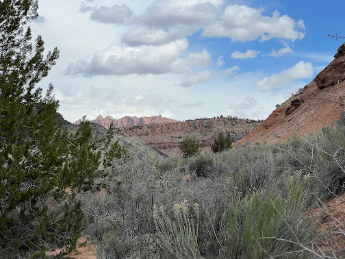
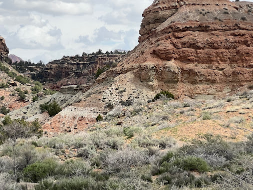
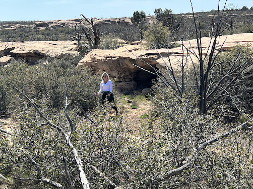
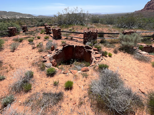
We visited the Red Cliffs archeological site while we were waiting for the parts to arrive.
Mark saw a horse head in the rocks. Can you spot it?
Lisa saw a horse's head near the top of this cliff. It is facing the left..
__________________________________
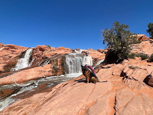
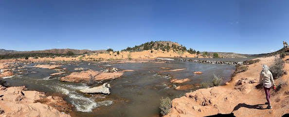
We went to Gunlock State Park while we were waiting on the parts to arrive. We had read about Gunlock State Park but had not had a chance to visit it previously. Because of the heavy snows this winter, the falls were especially extraordinary. This area of Utah was at 200-400% above normal snow fall for the year. The average snow fall in Utah at this time of year is 144" and currently it is at 168".
Karma could not help himself- he just had to get into the water. Luckily, he only put his front paws in the water and did not venture fully into the river. The current was very strong and there was a waterfall just past where we were sitting. If he had gotten swept away, we could not have saved him.
The Santa Clara river feeds into the waterfalls. There is a dam on the river to ensure there is enough water available to power the Hydro plant (750KW hydro Electric Plant) just downstream from here.
Cows were coming out of the hills looking to graze. Many of the parks we visit are either in BLM land or National Forest Service Land, so this property is free range for the livestock.
____________________
Ethel was finally fixed. The shocks were replaced and travel heights were corrected, so we were off to Bryce Canyon, even though it was late in the day. Luckily, we were able to get there before dark.






















No comments:
Post a Comment