Norwegian Sun- Cruise to Alaska
Originally, we had planned to spend the summer of 2023 traveling in Alaska for several months. Those plans had to change because our youngest son, Sid, got married in June. We welcomed a new daughter-in -law, Emma, to our family. Mark joked we could watch the wedding via a zoom call, but obviously, that was only a joke. Since we were not able to spend the summer in Alaska as we had planned, we felt the next best thing would be a cruise. We had a bonus addition to those plans, one of Mark's navy buddies, Pat Chasse and his wife Deb, joined us on the cruise. We were able to celebrate her birthday and their anniversary with them during the cruise. We took a 10 day cruise to the inland passage of Alaska. The cruise truly increased our desire to drive there and explore the areas more fully. We are very excited about the opportunity to drive there next summer. We saw a lot on the cruise with several ports of call, but we had limited time to fully experience all of Alaska's beauty and vastness. There is so much to see and do, we will need a few months up there to truly experience Alaska- and that will only put a dent in the possibilities.
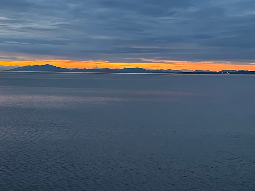
This beautiful sunrise greeted us the first morning of our cruise. We felt a sense of hope of things promised to come when the day starts off this beautifully. The untouched, raw landscapes where nature, not man, rules and controls things were truly gorgeous beyond mere mortal words. To fully submerse yourself in the sights, words were unnecessary because it was a very personal and private experience.
Ketchikan is
a city within the Ketchikan Gateway Borough of Alaska. It
is the state's southeasternmost major settlement. The town of Ketchikan is a
National Historic District.
Incorporated in 1900, Ketchikan is the earliest surviving city in
Alaska and is located on Revillagigedo Island, so named in 1793 by Captain George
Vancouver.
Ketchikan
is named after Ketchikan Creek, which flows through the town, and empties into the Tongass Narrows a short distance southeast of its downtown.
"Ketchikan" comes from the Tlingit name for the creek, Kitschk-hin,
the meaning of which is unclear. It may mean "the river belonging to
Kitschk"; other accounts claim it means "Thundering Wings of an
Eagle". In modern Tlingit, this name is Kichx̱áan.
Ketchikan
Creek served as a summer fish camp for Tlingit natives for an untold number of years before the town was established by Mike Martin in 1885. He was sent to
the area by an Oregon canning company to assess prospects. He established the
saltery, Clark & Martin, and a general store with Nova Scotia native
George Clark, who had previously been foreman at a cannery that burned down.
Ketchikan
became known as "Alaska's first city" due to its strategic position
at the southern tip of the Inside Passage, connecting the Gulf of
Alaska to Puget Sound.
In
1905, a mission house was built, which later became the Yates Memorial
Hospital in 1909. In 2020, the National Trust for Historic Preservation named
the former hospital as one of America's most endangered historic places.
Ketchikan
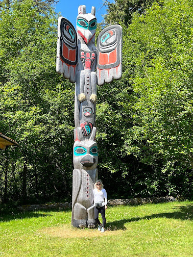
has the world's largest collection of standing totem poles. They were found
throughout the city and at four major parks dedicated to preserving the history and beauty of the native artwork. Most of the totems at Saxman Totem
Park and Totem Bight State Park are recarvings of older poles, a practice that
began during the Roosevelt Administration through the Civilian
Conservation Corps. The Totem Heritage Center displays preserved 19th-century
poles rescued from abandoned village sites near Ketchikan. The Chief Kyan pole
in Whale Park in the city center is one of the featured background images on
most US passports.
Hubbard Glacier, named after Gardiner Hubbard, is a glacier located in Wrangell–St. Elias National Park and Preserve in eastern Alaska and extends to Kluane National Park and Reserve in Yukon, Canada.
The longest section of Hubbard Glacier extends about 76 miles in length and about 7 miles wide.
Before it reaches the sea, Hubbard is
joined by the Valerie Glacier]to the west. Valerie has forward surges of its own ice, which contributes to the advancement of the ice flow. Experts believe it will eventually dam the Russell Fjord from Disenchantment
Bay waters.
The Hubbard Glacier ice margin has continued to advance for about a century according to the earliest known written records. In 1986, the Hubbard Glacier surged forward, blocking the outlet of Russell Fjord which created Russell Lake. The newly formed lake continued to fill with runoff. The vast volume of water caused to dam to fail and the area was again was opened to the sea. This was the largest recorded glacier flood in history. There are two documented times when the glacier dammed the Russell Fjord. The flooding is of special concern for the residents in the area and the sea life which sustains the residents.
It takes about 400 years for ice to traverse the length of the glacier, meaning that the ice at the foot of the glacier is about 400 years old. The glacier routinely calves (breaks off) icebergs the size of a ten-story building. Where the glacier meets the bay, most of the ice is below the waterline, and newly calved icebergs can shoot up quite dramatically, so that ships must keep their distance from the edge of the glacier in Disenchantment Bay.
The Municipality
and Borough of Skagway is a first-class borough on
the Alaskan Panhandle.
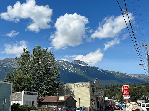
Skagway was an important port during the Klondike
Gold Rush. The White Pass and Yukon Route narrow gauge railroad, part
of the area's mining past, is now in operation purely for the tourist trade and
runs throughout the summer months. Skagway is also part of the setting for Jack
London's book The Call of the Wild, Will Hobbs's book Jason's
Gold, and for Joe Haldeman's novel, Guardian. The John
Wayne film North to Alaska (1960) was filmed nearby.
The story behind the name is that Sha-ka-ԍéi or Skagway ["Pretty Woman"] was the nickname of Kanagoo, a mythical woman who transformed herself into stone at Skagway Bay and who now causes the strong, channeled winds which blow toward Haines, Alaska. The rough seas caused by these winds are referred to by the use of Kanagoo's nickname, Sha-ka-ԍéi or Skagway.
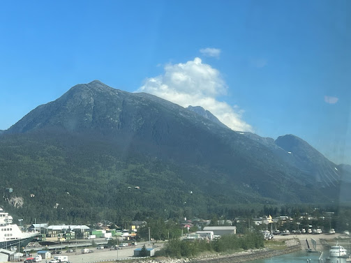
The Kanagoo stone formation is now known as Face
Mountain, which is seen from Skagway Bay. The Tlingit name for Face Mountain
is Kanagoo Yahaay.
One prominent resident of early Skagway was William "Billy" Moore, a former steamboat captain. As a member of an 1887 boundary survey expedition, he made the first recorded investigation of the pass over the Coast Mountains, which later became known as White Pass. He believed that gold lay in the Klondike because it had been found in similar mountain ranges in South America, Mexico, California, and British Columbia. In 1887, he and his son, J. Bernard "Ben" Moore, claimed a 160-acre homestead at the mouth of the Skagway River. Moore settled in this area because he believed it provided the most direct route to the potential goldfields. They built a log cabin, a sawmill, and a wharf in anticipation of future gold prospectors passing through.
The boundary between Canada and the United States along the Alaskan Panhandle was only vaguely defined then. There were overlapping land claims from the United States' purchase of Alaska from Russia in 1867 and British claims along the coast. Canada requested a survey after British Columbia united with it in 1871, but the idea was rejected by the United States as being too costly, given the area's remoteness, sparse settlement, and limited economic or strategic interest.
The gold rush changed everything. In 1896, gold was found in the Klondike region of Canada's Yukon Territory. In 1897, the steamer Queen docked at Moore's wharf with the first boat load of prospectors. Ships continued to bring thousands of hopeful miners into the new town as they prepared for the 500 mile journey to the gold fields in Canada. Moore was overrun by lot jumping prospectors- his land was stolen from him and sold to others.
American prospectors composed the majority of the 30,000 that flocked to the area. Some realized how
difficult the trek ahead would be en route to the gold fields, and chose to
stay behind to supply goods and services to the miners. The population was
estimated at 8,000 residents during the spring of 1898- with approximately 1,000
prospective miners passing through town each week.
Due to the sudden influx of visitors to Skagway, some town
residents began offering miners transportation services to aid them in their
journeys to the Yukon, often at highly inflated rates. A group of miners upset
with the treatment, organized a town council to help protect their interests.
But as the members of the council moved north to try their own hands at mining,
control of the town reverted to the more unscrupulous, most notably Jefferson
Randolph "Soapy" Smith.
Between 1897 and 1898, Skagway was a lawless town, described by
one member of the North-West Mounted Police as "little better
than a hell on earth." Fights, prostitutes and liquor were ever-present on
Skagway's streets, and con man "Soapy" Smith, who had risen to
considerable power, did little to stop it. Smith was a sophisticated swindler
who liked to think of himself as a kind and generous benefactor to the needy.
He was gracious to some, giving money to widows and halting lynchings, while
simultaneously operating a ring of thieves who swindled prospectors with cards,
dice, and shell games. His telegraph office charged five dollars to
send a message anywhere in the world. Consequently, unknowing prospectors sent
news to their families back home without realizing there was no telegraph
service to or from Skagway until 1901. Smith also controlled a
comprehensive spy network, a private militia called the Skagway Military
Company, the town newspaper, the Deputy U.S. Marshal's office and an array of
thieves and con-men who roamed about the town. Smith was shot and
killed by Frank Reid and Jesse Murphy in 1898, in the famed Shootout
on Juneau Wharf. Smith managed to return fire — some accounts claim the
two men fired their weapons simultaneously — and Frank Reid died from his
wounds twelve days later. Jesse Murphy is believed by some to be responsible
for killing Smith, but the official Coroner's Inquest ruled that it was Reid's
bullet that did the fatal work.
Smith and Reid are now interred at the Klondike Gold Rush
Cemetery, also known as "Skagway's Boot Hill."
The prospectors' journey began for many when they climbed the
mountains over the White Pass above Skagway and onward across the Canadian–US
border to Bennett Lake, or one of its neighboring lakes, where they
built barges and floated down the Yukon River to the gold fields
around Dawson City. Others disembarked at nearby Dyea, northwest of
Skagway, and crossed northward on the Chilkoot Pass, an existing Tlingit
trade route, to reach the lakes. The Dyea route fell out of favor when larger
ships began to arrive, as its harbor was too shallow for them except at high
tide. Officials in Canada began requiring that each prospector entering Canada
on the north side of the White Pass bring with him one ton of supplies, to ensure that he did not starve during the winter. This placed a
large burden on the prospectors and the pack animals climbing the steep pass.
In 1898, a 14-mile, steam-operated aerial tramway was
constructed up the Skagway side of the White Pass, easing the burden of those
prospectors who could afford the fee to use it. The Chilkoot Trail
tramways also began to operate in the Chilkoot Pass above Dyea. In 1896,
before the Klondike gold rush had begun, a group of investors saw an
opportunity for a railroad over that route. It was not until May 1898 that the White
Pass and Yukon Route began laying narrow gauge railroad tracks
in Skagway. The railroad depot was constructed between September and December
1898. This destroyed the viability of Dyea, as Skagway had both the deep-water
port and the railroad.
By 1899, the stream of gold-seekers had diminished and Skagway's economy began to collapse. By 1900, when the railroad was completed, the gold rush was nearly over. In 1900, Skagway was incorporated as the first city in the Alaska Territory. Much of the history of Skagway was saved by early residents such as Martin Itjen, who ran a tour bus around the historical town. He was responsible for saving and maintaining the gold- rush cemetery from complete loss. He purchased Soapy Smith's saloon (Jeff Smith's Parlor) from going the way of the wrecking ball, and placed many early artifacts of the city's early history inside and opened Skagway's first museum.
Ammolite is an opal-like organic
gemstone found primarily along the eastern slopes of the Rocky
Mountains of North America. It is made of the fossilized shells
of ammonites, which in turn are composed primarily of aragonite, the
same mineral contained in nacre, with a microstructure inherited
from the shell. It is one of few biogenic gemstones; others include amber and pearl. In
1981, ammolite was given official gemstone status by the World Jewelry
Confederation (CIBJO), the same year commercial mining of ammolite began.
It was designated the official gemstone of the City of Lethbridge, Alberta
in 2007.
The city of Juneau is the capital
city of Alaska. Located in the Gastineau
Channel and the Alaskan panhandle, it is a consolidated
city-borough and the second-largest city in the United States by area.
Juneau was named the capital of Alaska in 1906, when the government of what was
then the District of Alaska was moved from Sitka as
dictated by the U.S. Congress in 1900. The municipality unified in 1970, when the city of Juneau merged with the city of Douglas and
the surrounding Greater Juneau Borough to form the current
municipality, which is larger by area than both Rhode Island and Delaware.
Downtown Juneau is nestled at the base of Mount Juneau and
across the channel from Douglas Island.
The city is named after a gold prospector from Quebec, Joe
Juneau, though the place was once called Rockwell and
then Harrisburg (after Juneau's co-prospector, Richard
Harris).
Juneau is unique among the 49 U.S. capitals on mainland North America in that there are no roads connecting the city to the rest of the state or North America. Honolulu, Hawaii, is the only other state capital not connected by road to the rest of North America. The absence of a road network is due to the extremely rugged terrain surrounding the city. This in turn makes Juneau a de facto island city in terms of transportation, since all goods coming in and out must go by plane or boat, in spite of the city's location on the Alaskan mainland. Downtown Juneau sits at sea level, with tides averaging 16 feet, below steep mountains about 3,500 to 4,000 feet high. Atop these mountains is the Juneau Icefield, a large ice mass from which about 30 glaciers flow; two of these, the Mendenhall Glacier and the Lemon Creek Glacier, are visible from the local road system. The Mendenhall glacier has been gradually retreating, therefore, its front face is declining in width and height.
The Eldred Rock Light is a historic octagonal lighthouse adjacent to Lynn Canal. It is the last of the ten lighthouses constructed in Alaska between 1902 and 1906. It was also the last of 12 manned lighthouses in Alaska.
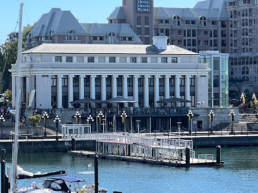
Victoria is the
capital city of the Canadian province of British Columbia, on
the southern tip of Vancouver Island off Canada's Pacific coast.
The city has a population of 91,867, and the Greater Victoria area
has a population of 397,237. The city of Victoria is the 7th most densely
populated city in Canada.
Victoria is the southernmost major city in Western Canada and
is about 62 mi southwest from British Columbia's largest city of Vancouver on
the mainland. The city is about 62 mi from Seattle by airplane, seaplane, ferry,
or the Victoria Clipper passenger-only ferry, and 25 mi from Port
Angeles, Washington, by ferry Coho across the Strait
of Juan de Fuca.
Named for Queen Victoria, the city is one of the oldest in
the Pacific Northwest, with British settlement beginning in 1843. The city
has retained a large number of its historic buildings, in particular its two
most famous landmarks, the Parliament Buildings (finished in 1897 and home of
the Legislative Assembly of British Columbia) and the Empress hotel (opened
in 1908). The city's Chinatown is the second oldest in North America,
after San Francisco's. The region's Coast Salish First Nations peoples
established communities in the area long before European settlement, which had
large populations at the time of European exploration.
Known as "the Garden City", Victoria is an attractive
city and a popular tourism destination with a regional technology sector that
has risen to be its largest revenue-generating private industry. Victoria
is in the top twenty of world cities for quality-of-life. Life here is very expensive and the weather is unusually mild year-round.

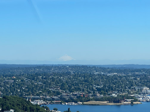
Seattle is situated on an isthmus between Puget
Sound (an inlet of the Pacific Ocean) and Lake Washington. It is
the northernmost major city in the United States, located about 100 miles
(160 km) south of the Canadian border. A major gateway for trade with East
Asia, the Port of Seattle is the fourth-largest port in North America
in terms of container handling as of 2021.
The Seattle area was inhabited by Native Americans for
at least 4,000 years before the first permanent European settlers. Arthur
A. Denny and his group of travelers, subsequently known as the Denny
Party, arrived from Illinois via Portland, Oregon, on the schooner Exact at Alki
Point in 1851. The settlement was moved to the eastern
shore of Elliott Bay in 1852 and named "Seattle" in honor
of Native American Chief Si'ahl of the local Duwamish and Suquamish tribes.
Seattle currently has high populations of Native Americans alongside Americans
with strong Asian, African, European, and Scandinavian ancestry.
Logging was Seattle's first major industry, but by the late
19th century, the city had become a commercial and shipbuilding center as a
gateway to Alaska during the Klondike Gold Rush. Growth after World
War II was partially due to the local Boeing company, which
established Seattle as a center for aircraft manufacturing. The Seattle area
developed into a technology center from the 1980s onwards with
companies like Microsoft becoming established in the region. Microsoft founder Bill Gates is a Seattleite by birth. Internet
retailer Amazon was founded in Seattle in 1994. The stream of new
software, biotechnology, and Internet companies led to an economic
revival, which increased the city's population by almost 50,000 between 1990
and 2000.
The culture of Seattle is heavily defined by its significant
musical history. Between 1918 and 1951, nearly 24 jazz nightclubs
existed along Jackson Street, from the current Chinatown/International
District to the Central District. The jazz scene nurtured the early
careers of Ernestine Anderson, Ray Charles, Quincy Jones, and
others. The city is also the origin of rock acts such as Foo
Fighters, Heart, and Jimi Hendrix.
Gum
Wall
Down
an unassuming alleyway in Pike Place Market is a hidden work of art dubbed The
Gum Wall.
This
unexpected and colorful display is an intriguing representation of Seattle’s
unique charm and character.
The
Gum Wall started in the 1990s when local patrons and performers at Unexpected
Productions stuck their used gum on the wall. Since those days,
the wall has grown piece by piece to cover an enormous expanse of brick and
continues to expand down Post Alley.
The resulting colors and overall imagery are enough to catch the eye of any passersby.


