Featured Post

Welcome to Our Website

       We started making plans for this lifestyle 3 years ago.  We looked at all the options for travel- including trikes, hotels and a RV. ...

Monday, April 24, 2023

Ruby's Inn RV Park and Campground - Bryce City Utah

Ruby's Inn RV Park and Campground - Bryce City, Utah 

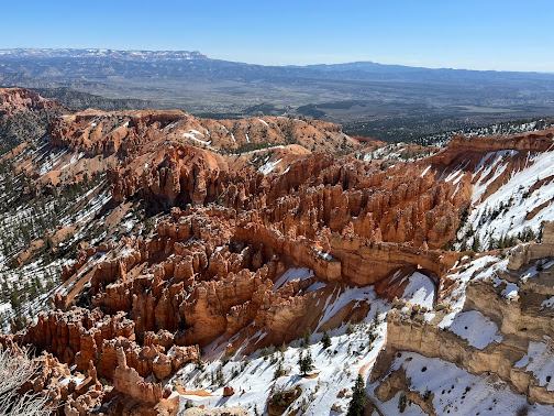
Bryce Canyon National Park is located in southwestern Utah. The major feature of the park is Bryce Canyon, which despite its name, is not a canyon, but a collection of giant natural amphitheaters along the eastern side of the Paunsaugunt Plateau. Bryce is distinctive due to geological structures called hoodoos, formed by frost weathering and stream erosion of the river and lake bed sedimentary rocks. The red, orange, and white colors of the rocks provide spectacular views for park visitors. Bryce Canyon National Park is much smaller and sits at a much higher elevation than nearby Zion National Park. The rim at Bryce varies from 8,000 to 9,000 feet.

The Bryce Canyon area was settled by Mormon pioneers in the 1850's and was named after Ebenezer Bryce, who homesteaded in the area in 1874. The area around Bryce Canyon was originally designated as a national monument by President Warren G. Harding in 1923 and was redesignated as a national park by Congress in 1928. The park covers 35,835 acres and receives substantially fewer visitors than Zion National Park (nearly 4.3 million in 2016) or Grand Canyon National Park (nearly 6 million in 2016), largely due to Bryce's more remote location. .

Rainbow Point, the highest part of the park at 9,105 feet is at the end of the 18-mile scenic drive. From there, Aquarius Plateau, Bryce Amphitheater, the Henry Mountains, the Vermilion Cliffs and the White Cliffs can be seen. Yellow Creek, where it exits the park in the north-east section, is the lowest part of the park at 6,620 feet.

Lisa was standing on the side of road where plows have been piling up snow.


Lisa was standing on the side of road.  Plows have recently started clearing the road. If you look closely at the snow, you can see many different snowfalls. This was not a drift or pileup of snow from the road. This was a clean cut through the snow. One of the rangers told us that last week, the snow was three feet higher than it is now. Several roads and trails are still closed due to heavy snow. This winter had a higher than normal amount of snow fall. 


Mark calls this the "Vanna White" position.


We both really hate the cold. We were not expecting this much snow on the ground this late in the season. Thankfully, the roads were clear. The wind is brutal. 


We climbed all over these rocks. We have definitely exceeded our comfort zone a few times.


Have I mentioned how much we hate cold weather?


Swamp Canyon and Aqua Canyon have large stands of Ponderosa Pines in them.  Some of these pines reach 150' tall with a trunk diameter of 5'.  The Ponderosa Pine is unique since in most cases, the old pine will survive a fire.  As the the Ponderosa Pine ages, the bark sheds and the remaining bark is red.  This old forest has survived fires for 100's of years.


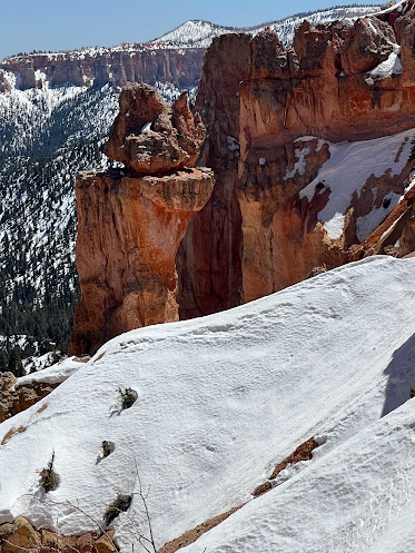
The rocks that look like totem poles are called hoodoos. Bryce has more hoodoos than any other park.


This area has been named "Inspiration Point".  It inspired me to hike down off this mountain.


 To access the Queens Garden hiking path, you must first climb through this arch..


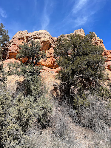
The root of this Juniper tree climbs over the edge of the canyon. You see some very creative means of survival throughout the canyons and the desert.


The hallmark of Sunset Point is the many hoodoos.


This Juniper tree has a lot of surface roots that cling to the top and side of the canyon. There is no soil around the tree that you would typically expect.  This tree is literally growing off the side of the cliff on solid rock. How does this tree even survive, much less remain standing despite the strong winds so common in the area?


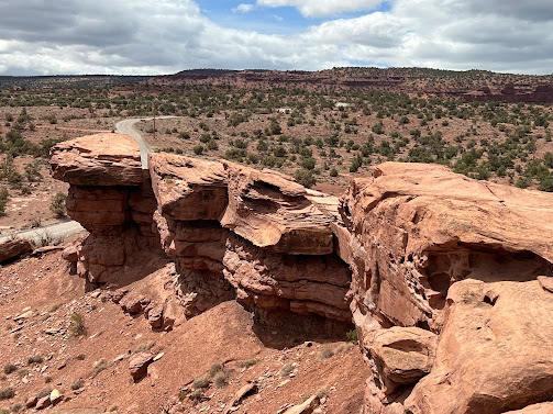
This formation is called a natural bridge as it connects the columns of rocks. 


Prairie dogs are herbivorous burrowing ground squirrel’s native to the grasslands of North America.  In the United States, they range primarily to the west of the Mississippi River, though they have also been introduced in a few eastern locales. Despite the name, they are not actually canines; prairie dogs, along with the marmots and chipmunks, belong to the squirrel family.

Prairie dogs are considered a keystone species, with their mounds often being used by other species. Their mound-building encourages grass development and renewal of topsoil, with rich mineral, and nutrient renewal in the soil, which can be crucial for soil quality and agriculture. They are extremely important in the food chain, being important to the diet of many animals such as the black-footed ferret, swift fox, golden eagle, red tailed hawk, American badger, and coyote. Other species, such as the golden-mantled ground squirrel, mountain plover, and the burrowing owl, also rely on prairie dog burrows for nesting areas. Prairie dogs have some of the most complex systems of communication and social structures in the animal kingdom.


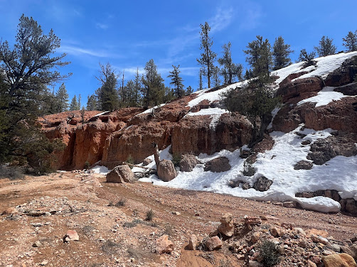
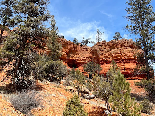
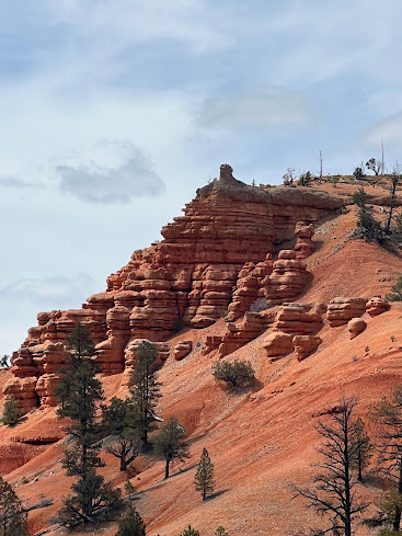
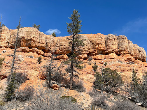
The Red Canyon is located just off Highway 12 enroute to Bryce Canyon National Park amid the spectacular red sandstone spires and formations. This area has been called the "most photographed place in Utah". The Red Canyon Trail System is widely known and very popular. Nearby trails include Pink LedgesHoodooBirdseye and Golden wall. There are many trails open to foot traffic, as well as bicycle, horse and ATV.


On June 1 1925, a 315 car caravan led by Governor George Dern arrived at the Red Canyon Tunnels to celebrate the Opening of Utah State Park (Later Bryce Canyon). A flower strewn gate closed the entrance to the second tunnel, and a banner declared Welcome to Utah's Fairyland. Children dressed as fairies tied flowers and long ribbons to the bumpers of the Governors car. When the Governor announced his belief in fairies, two young elves opened the gates while a band played, perched atop the tunnel. began to play. Dancing fairies pulled on the streamers to pull the car through the tunnel. Since then the tunnels have acted as the magical entrance to Red and Bryce Canyon.


We hiked all throughout the Red Canyon. These were some views that motivated us to climb higher and go further into the canyon. We carry food and water with us as we hike, because these hikes tend to be an all day event. National Parks typically do not allow dogs on the trails, but state parks do. Karma has his own backpack for his water and bowl. We try to make sure he is included on our adventures at least every other day. He gets so excited when he sees us packing a lunch and putting on our hiking boots. 


Butch Cassidy was born and raised in the area.  Legend has it that he hid out in the surrounding canyons.
____________________________________________

Capitol Reef National Park is in south-central Utah. The park is approximately 60 miles long on its north–south axis and just 6 miles wide on average. The park was established in 1971 to preserve 241,904 acres of desert landscape and is open all year. Most people visit the park during May through September because of the weather.

 Capitol Reef National Park was designated a national monument in 1937, by President Franklin D. Roosevelt to protect the area's colorful canyons, ridges, buttes, and monoliths; however, it was not until 1950 that the area officially opened to the public. Road access was improved in 1962 with the construction of State Route 24 through the Fremont River Canyon. The drive to the park offers spectacular views, but also ignites some anxiety for the driver.    The drops into the canyons were deep and without guard rails or shoulders on the road. There was zero room for error. 


Marmots are large ground squirrels, with 15 species living in Asia, Europe, and North America. These herbivores are active during the summer, when they can often be found in groups, but are not seen during the winter, when they hibernate underground. They are the heaviest members of the squirrel family.  I guess no one told him it was still cold.  


The mule deer is indigenous to western North America. They get their name because of their ears, which are large like those of the mule. 

Unlike the related white-tailed deer, which is found throughout most of North America, mule deer are only found on the western Great Plains, in the Rocky Mountains, in the southwest United States, and on the west coast of North America.


This is named Cassidy Arch. The colors and patterns are breathtaking. 


This is Echo Cliff.


The Golden Throne is a 7,041-foot mountain in Capitol Reef National Park in  Utah. It is a rock formation dome made of a gold color stained Navajo Sandstone. The gold color is unique because normally the sandstone is creamy white or red.


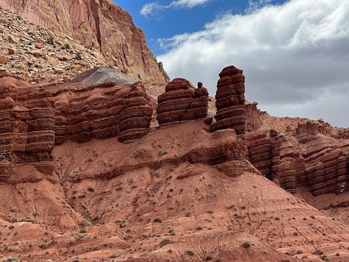
A close up view of different layers of rock and sediment in Capitol Reef that results in the beautiful colors and characteristics in the area. By studying the rocks, geologists have learned much about the different periods in time. 


The area has amazing variations in color, formations and types of rock. 


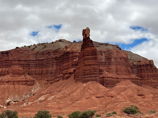
This section is named Cathedral Valley.


These gorgeous views were along our route to the park from Bryce.
__________________________

Kodachrome Basin is a state park in  Utah. It is situated 5,800 feet above sea level, 12 miles south of Utah Route 12, and 20 miles southeast of Bryce Canyon National Park.


Lisa was preparing for the start of a 5 mile hike into the park.


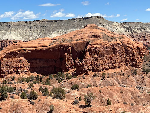
Notice the columns of different rock in the middle of the red stone.  It is so very interesting how these many variations of rocks were formed  millions of years ago.


Notice the sage brush growing on top of the column.  That stuff will grow anywhere.


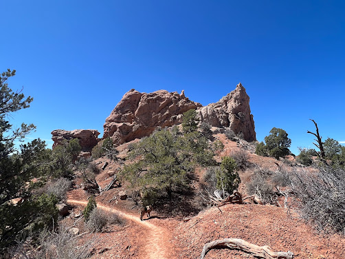
Lisa and Karma were at the base of the Hoodoo.


Karma found some shade under a Juniper tree.  


We saw the Ballerina Spire while on our hike.


Lisa and Karma were at the base of Ballerina spire.


Sentinel Spire stands proudly by itself. These various formations seem so random at times. Formations randomly seem to come out of no where. 


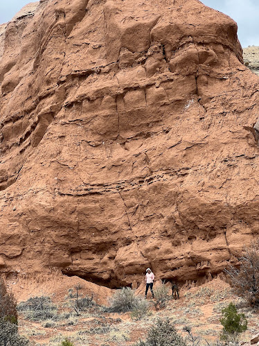
Lisa and Karma were exploring the base of a cliff in Kodachrome Basin State Park.


This massive formation stands tall, proud and completely random with nothing else remotely like it nearby. 


We were able to see Grosvenor Arch while hiking through these canyons. This is a great example of the variations in color and various formations. 

We have seen so many rocks in all sizes, colors and formations. And yet, we are still in awe of their beauty. Thankfully, the trails have had very few other hikers as we continue to scramble over rocks out west. I think the peace and tranquility are as impressive as the raw beauty we have seen.